For more photos click here
76 Nautical miles on Port tack in Cook Strait
Planning for our 2018 Caper began in spring 2017 which resulted in a decision for a group of Welsford yawls to sail across Cook Strait somewhere in the 2 weeks following February 7th to return 7 to 10 days later depending upon a suitable weather window.
Then came the January heat wave with no wind and temperatures in the 25 Celsius to 29 Celsius range and the Cook Strait looked like a warm mill pond for weeks. 40+ days without rain and all Wellingtonians were baffled by the unheard of tropical conditions. Fearing we may be motoring for much of the way we all increased our fuel carrying capacity while fearing sunstroke Richard and I both built fabric sunshades envisaging sitting in still hot anchorages under a blazing sun.
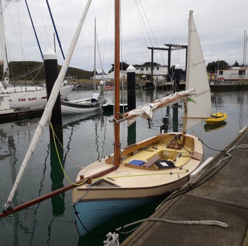
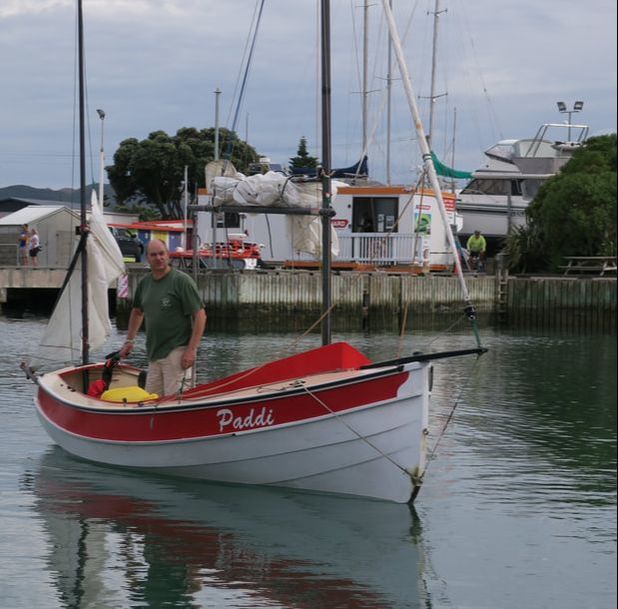
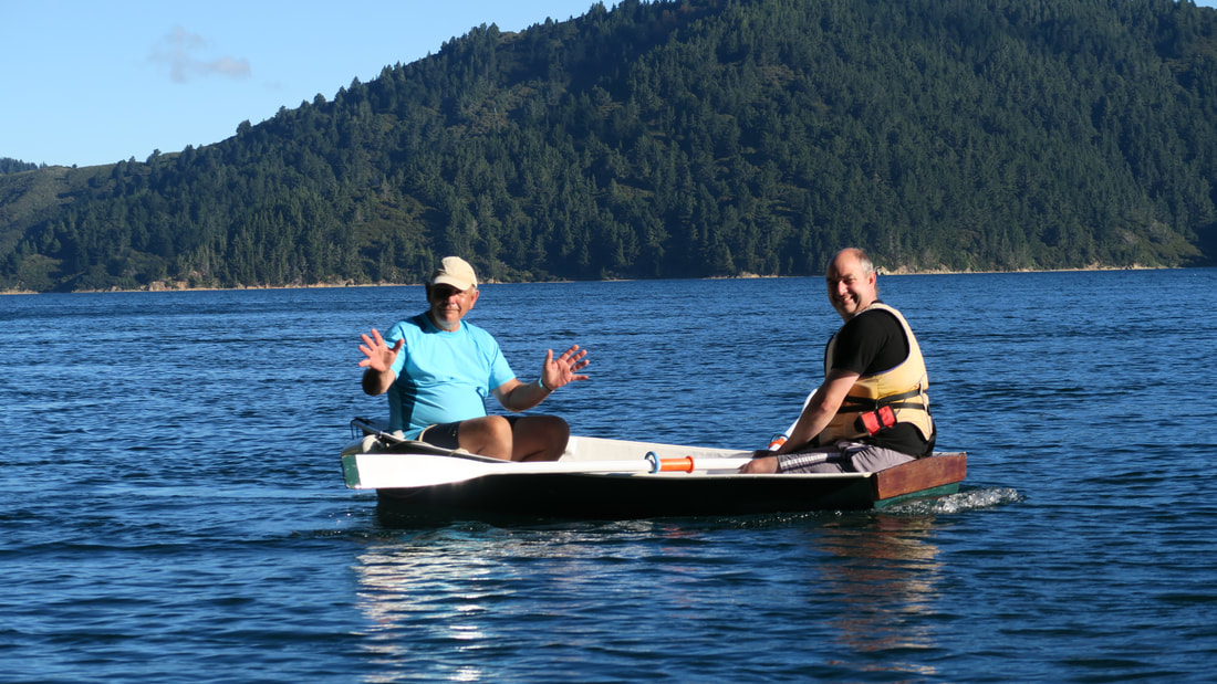
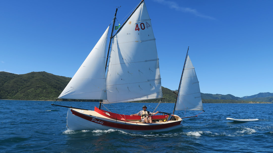
Ultimately Paddi (Grant), Bootstrap (Richard) and myself in Emeraude left Mana CC at 10:45 on Saturday the 10th in warm conditions with the forecast talking about SE and then later SW winds of 10 knots with a little cloud.
Then came the January heat wave with no wind and temperatures in the 25 Celsius to 29 Celsius range and the Cook Strait looked like a warm mill pond for weeks. 40+ days without rain and all Wellingtonians were baffled by the unheard of tropical conditions. Fearing we may be motoring for much of the way we all increased our fuel carrying capacity while fearing sunstroke Richard and I both built fabric sunshades envisaging sitting in still hot anchorages under a blazing sun.
Ultimately Paddi (Grant), Bootstrap (Richard) and myself in Emeraude left Mana CC at 10:45 on Saturday the 10th in warm conditions with the forecast talking about SE and then later SW winds of 10 knots with a little cloud.
|
|
So it was until we reached Mana Island about 2 miles out from Mana to find no SE wind at all but a SW at about 10 knots which put us hard on the wind on Port tack heading into a modest chop. Gradually over the next couple of hours the chop and the SW wind built, and built , the sun disappeared, it starts to get cold …and then suddenly I am aware that both Bootstrap and Paddi have disappeared !
We are surrounded by a kind of thin fog in 15 knots of wind that destroyed the visibility. As you would expect this is the exact moment that Richard’s GPS decides to fail, and amazingly Grant’s GPS dies in sympathy with it! Discussing our missing friend on the VHF Grant and I decide to turn back to locate Richard who eventually appears out of the murk. He was elated to see us as it is terribly disconcerting having no GPS while sailing in a foggy world about a mile in diameter with no visible reference points.
Reviewing the GPS track later we were about a mile east of Fisherman’s Rock when we turned back to locate Richard so we were about half way at that stage. Grant being a well prepared soul had a second GPS which woke up for him and served for the rest of the voyage.
With the fleet reunited, and keeping in sight of each other, off we go only to get almost immediately hammered by rising winds ( way over the forecast 10 knots !) and misty rain with still very limited visibility, although we did see a ghostly coastal ship slip past in the gloom about this time. Before long we all hove to and reefed, which was quite difficult in a steep and very confused chop of a metre an half bouncing us around in all directions. In fact I settled for jib and jigger for about an hour. Meantime, to keep up, Richard motor-sailed under jib and jigger (god bless Yamaha 2hp motors!) so before long with Grant almost disappearing in the murk and Richard getting well ahead of me the main went back up with one reef in place so I could keep pace. Very glad I had a large and effective Thermos full of coffee and (easily managed with one hand) crude man food sandwiches to provide energy on this long trip.
So now we are bashing to windward in 15 + knots into this confused chop with plenty of spray and the odd solid one coming over the top. Happily I fitted bilge pumps to Emeraude as they had the odd bit of work now and then on this part of the voyage, but plenty more work awaited them! Foolishly (and because initially it was very warm) I left it too late to put on my wet weather gear and by now was only able to get my jacket on as sailing single handed in these conditions is a full time two handed job.
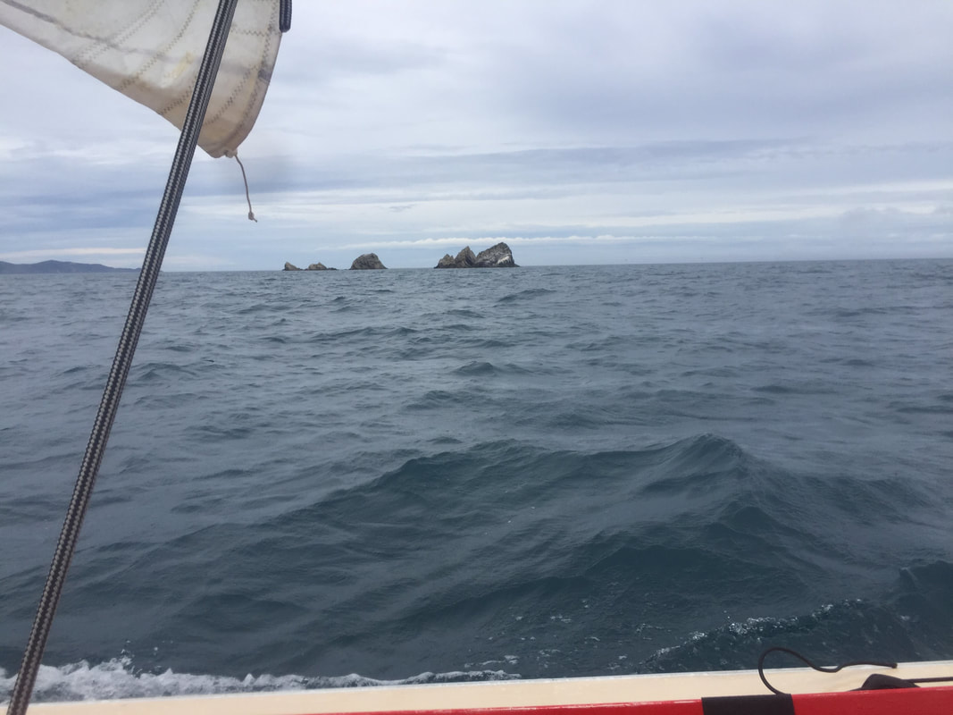
Grinding on and on in grey misty lumpy conditions and then suddenly a voice on the radio!.. Joy at last! After a seemingly interminable sail in the murk Grant spots Cape Koamaru and sees a glimpse of Cape Jackson so we know we are on course and we have not been sailing into oblivion somewhere toward Australia!
An hour or so later we sail clear of the foggy murk and are now sailing by “visual flight rules “so Grant (followed by Richard) heads for Koamaru while I stand on to a waypoint north of Cook Rock. Weird tidal over-falls are visible in this area but are not too threatening, at least on this day! By now I have washer woman’s fingers and am starting to shiver a bit. So with Motoara Island in sight, the sea moderating and White rocks off my Port side the motor is woken up and Emeraude motor sails for the last 3 miles into the wee bay just south of Ships Cove.
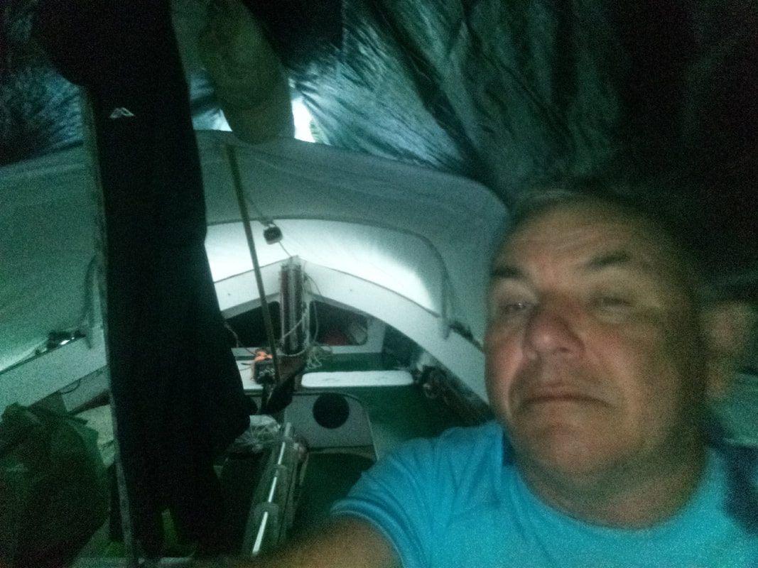
Taking advice from Hugh on a nearby 10.6 Lotus (I think) I anchored close to shore and have my tent and dodger set up and the kettle on when the other two arrive. Last night’s frozen left-overs from the Ice box are soon in the pan and with a warm meal on the inside and a roof over the top and a safe anchorage, life looks brighter.
We are surrounded by a kind of thin fog in 15 knots of wind that destroyed the visibility. As you would expect this is the exact moment that Richard’s GPS decides to fail, and amazingly Grant’s GPS dies in sympathy with it! Discussing our missing friend on the VHF Grant and I decide to turn back to locate Richard who eventually appears out of the murk. He was elated to see us as it is terribly disconcerting having no GPS while sailing in a foggy world about a mile in diameter with no visible reference points.
Reviewing the GPS track later we were about a mile east of Fisherman’s Rock when we turned back to locate Richard so we were about half way at that stage. Grant being a well prepared soul had a second GPS which woke up for him and served for the rest of the voyage.
With the fleet reunited, and keeping in sight of each other, off we go only to get almost immediately hammered by rising winds ( way over the forecast 10 knots !) and misty rain with still very limited visibility, although we did see a ghostly coastal ship slip past in the gloom about this time. Before long we all hove to and reefed, which was quite difficult in a steep and very confused chop of a metre an half bouncing us around in all directions. In fact I settled for jib and jigger for about an hour. Meantime, to keep up, Richard motor-sailed under jib and jigger (god bless Yamaha 2hp motors!) so before long with Grant almost disappearing in the murk and Richard getting well ahead of me the main went back up with one reef in place so I could keep pace. Very glad I had a large and effective Thermos full of coffee and (easily managed with one hand) crude man food sandwiches to provide energy on this long trip.
So now we are bashing to windward in 15 + knots into this confused chop with plenty of spray and the odd solid one coming over the top. Happily I fitted bilge pumps to Emeraude as they had the odd bit of work now and then on this part of the voyage, but plenty more work awaited them! Foolishly (and because initially it was very warm) I left it too late to put on my wet weather gear and by now was only able to get my jacket on as sailing single handed in these conditions is a full time two handed job.
Grinding on and on in grey misty lumpy conditions and then suddenly a voice on the radio!.. Joy at last! After a seemingly interminable sail in the murk Grant spots Cape Koamaru and sees a glimpse of Cape Jackson so we know we are on course and we have not been sailing into oblivion somewhere toward Australia!
An hour or so later we sail clear of the foggy murk and are now sailing by “visual flight rules “so Grant (followed by Richard) heads for Koamaru while I stand on to a waypoint north of Cook Rock. Weird tidal over-falls are visible in this area but are not too threatening, at least on this day! By now I have washer woman’s fingers and am starting to shiver a bit. So with Motoara Island in sight, the sea moderating and White rocks off my Port side the motor is woken up and Emeraude motor sails for the last 3 miles into the wee bay just south of Ships Cove.
Taking advice from Hugh on a nearby 10.6 Lotus (I think) I anchored close to shore and have my tent and dodger set up and the kettle on when the other two arrive. Last night’s frozen left-overs from the Ice box are soon in the pan and with a warm meal on the inside and a roof over the top and a safe anchorage, life looks brighter.
|
|
Sunday morning we know that rain is coming together with a strong NW so we vacate Ship Cove and sail for Tawa bay in Endeavour Inlet in very overcast conditions with a light southerly. We have a lovely sail in light weather down the side of Long Island spotting many Dolphins in line astern crossing our path at one stage. Well before we get there we now have no wind but the heavens open with a biblical downpour…… that does not stop….for hours. So now we have 3 open boats motoring for about an hour in rain so heavy that its bouncing 100 mm off the dead flat sea and filling the boat with rain water so fast the bilge pumps are kicking in every 20 minutes!
Tawa Bay is sheltered in NW winds so we anchor very close to shore in about 15 metres of water and lie to a SW wind which suddenly has teeth in it as well as constant rain... Where is the NW ??
Once our boom tents are up we all turn to bailing and mopping out. A disheartening task as by now everything is damp and despite my best sewing efforts I still have a few annoying drips. In my set up the tarpaulin boom tent goes over the boom and with fierce wind pushing it, water was being blown along the flaked sail under the tarp.. And of course it eventually gets to drips onto the resident sailor inside! The other thing to torment us was the wind swirling around the compass all the time, sometimes at 30 knots plus. Because of this from time to time we had a few gentle comings together in the night so sleep was spasmodic. Poor old Grant dragged his anchor just before nightfall and ended up on the beach before relaying his anchor, all the while the rain poured down. Gosh isn’t dinghy cruising fun ?
|
|
Monday… Sunshine ..no rain.. everything is good again ! The NW is still with us but about 15 knots in places and almost zero in others. After breakfast we all sailed off our anchors in most seamanlike fashion heading for Mint bay. Mint bay faces SE and holds fond memories for Richard who camped there a few years ago. Perfect spot to dry out with a gentle offshore NW…right?
We enjoy a sunny sail downwind from Tawa Bay although exploring on the south shore of Endeavour Inlet Grant almost gets embayed on a lee shore but finally claws his way out of a lovely wee bay. Waiting for the other two boats,and hove to in the sun in the middle of Queen Charlotte off Endeavour Inlet, I finally had enough cell signal to call wife and give her an update, and download a Metservice Brothers Island forecast page. So lunch at Mint bay is the order of the day and with almost no wind I motor in and pick up the mooring so the other two can raft up with me. NW clouds passing overhead but we have a SW wind and an on shore chop….seems Queen Charlotte is crazy place with crazy winds.
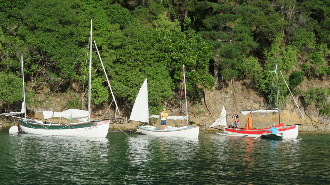
Consulting the Cruising Guide is looks like the east side of Blumine Island has a couple of suitable anchorages in NW conditions so we head off for there keeping an eye out for Andrew sailing out to join us from Picton. East of Blumine we are now treated with a brisk NE which has us hard on the wind ( yep on port tack again) and making the back of Blumine look rather dismal. But look there is a lovey beach with flat water dead ahead ..So we rock up to Te Ipapakereru bay which is equipped with a lovely sandy beach and sheltered from the brisk NE…Beautiful ! .. Nope.!
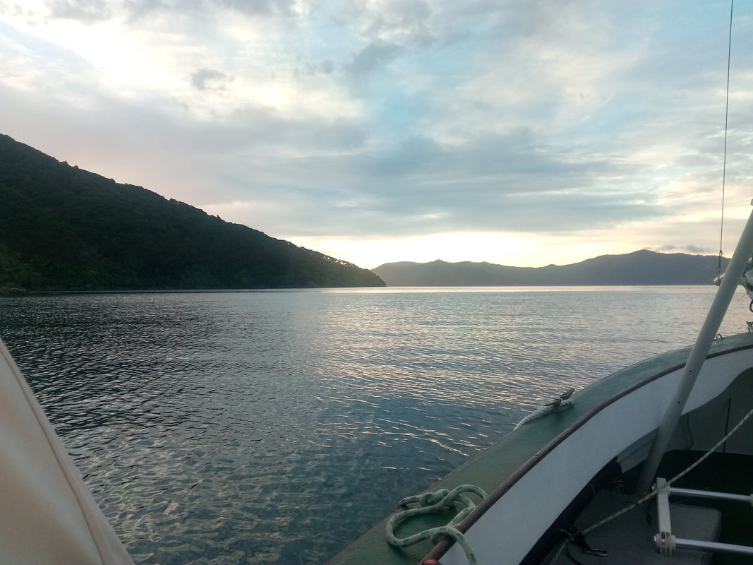
20 minutes later the NW arrives with a vengeance and again we are suddenly on a lee shore in a chop! Up anchor and we set off again seeking overnight shelter and by now it is after 4pm.Upside is the wind is manageable and the sun is out ! Blumine anchorages were horridly windy so we finally head off to Spenser Bay on the other side of the sound. Finally the wind gods relent and we have a lovely night moored stern to a wee beach at Spenser Bay and had a communal dinner on Emeraude (see the pix elsewhere) with Andrew and Xavier joining us. Wakes from passing commercial vessels were an irritation while the metre+ high surf wake from the huge cruise liner, Ovation of the Seas, was alarming with the speed and height of the waves crashing ashore around us.
That night we reviewed the available forecast information and decided the only window to return back to Mana was Wednesday or possibly Thursday after which winds 25 knots plus were forecast with one day 50knots + forecast. Definitely not the place for cruising dinghies!
We enjoy a sunny sail downwind from Tawa Bay although exploring on the south shore of Endeavour Inlet Grant almost gets embayed on a lee shore but finally claws his way out of a lovely wee bay. Waiting for the other two boats,and hove to in the sun in the middle of Queen Charlotte off Endeavour Inlet, I finally had enough cell signal to call wife and give her an update, and download a Metservice Brothers Island forecast page. So lunch at Mint bay is the order of the day and with almost no wind I motor in and pick up the mooring so the other two can raft up with me. NW clouds passing overhead but we have a SW wind and an on shore chop….seems Queen Charlotte is crazy place with crazy winds.
Consulting the Cruising Guide is looks like the east side of Blumine Island has a couple of suitable anchorages in NW conditions so we head off for there keeping an eye out for Andrew sailing out to join us from Picton. East of Blumine we are now treated with a brisk NE which has us hard on the wind ( yep on port tack again) and making the back of Blumine look rather dismal. But look there is a lovey beach with flat water dead ahead ..So we rock up to Te Ipapakereru bay which is equipped with a lovely sandy beach and sheltered from the brisk NE…Beautiful ! .. Nope.!
20 minutes later the NW arrives with a vengeance and again we are suddenly on a lee shore in a chop! Up anchor and we set off again seeking overnight shelter and by now it is after 4pm.Upside is the wind is manageable and the sun is out ! Blumine anchorages were horridly windy so we finally head off to Spenser Bay on the other side of the sound. Finally the wind gods relent and we have a lovely night moored stern to a wee beach at Spenser Bay and had a communal dinner on Emeraude (see the pix elsewhere) with Andrew and Xavier joining us. Wakes from passing commercial vessels were an irritation while the metre+ high surf wake from the huge cruise liner, Ovation of the Seas, was alarming with the speed and height of the waves crashing ashore around us.
That night we reviewed the available forecast information and decided the only window to return back to Mana was Wednesday or possibly Thursday after which winds 25 knots plus were forecast with one day 50knots + forecast. Definitely not the place for cruising dinghies!
|
|
Accordingly on Tuesday we set off in a very light NW and bright sunshine for a text book cruising dinghy sail to Resolution bay figuring that would be a good set off point for the voyage home on Wednesday or Thursday. Grant got to have a gentle encounter with Outward Bound cutter enroute and I got stuck at Scott point with contrary or no wind and a bad tidal set for over an hour but that’s part of the fun when the weather is nice!
Finally we get just around the corner Into Resolution Bay and bang….. the NW is back at 15 to 20 knots and again we are seeking a calm overnight anchorage. After exploring much of the bay unsuccessfully Richard found a nice spot on the NE side of the bay complete with resident seal. As evening fell the grumpy NW dissipated to leave us with a pleasant night on the anchor. Or last supper was again a communal affair, this time cooked on the beach with steak, onions, peas , rolled roast , roast potatoes, sausage and fresh cooked scones and jam for dessert.
Grant found that 30 knots by midday was forecast for Thursday so that made the decision to head home Wednesday very easy.
|
|
Wednesday morning was calm and sunny with a light NW and we were on our way before 9am to beat out of the sound towards Cook Rock against the NW wind which was forecast to back to North.
Richard has provided an eloquent description of his homeward crossing which I have reproduced here:
We managed to make the crossing back to Mana today. Quite an experience it was. We all started off with a reef in and then shook them out on the other side of Brothers. The wind slowly increased to about 15-20 Kts from the North - not quite a beam reach.
Soon after leaving Brothers we could make out Kapiti and then Mana Island, Looked so close. Hours later it still look the same size! As we got closer to Mana Island we started hitting a huge steep sea with the odd breaking wave. Spray and the occasional wave crashing over the boat, I ended up running my bilge pump continuously - until the battery died.
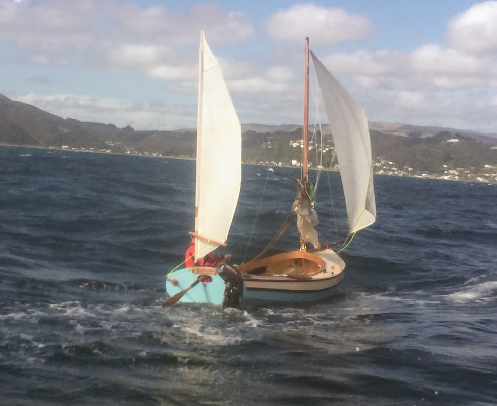
At the top of Mana Island was a nasty tidal race. In the middle of this mess of waves the rudder on Bootstrap broke (bottom pintle ripped out). I madly dropped the main and then started the engine. By turning the engine around I could get some semblance of control. Terrifying experience with the boat been thrown around and the cliffs of Mana just off my starboard bow.
In the lee of Mana island things were a bit quieter and I found that by sticking the paddle through the hole in the transom for the tiller, I steer Bootstrap under jib and jigger. I then tried to get fancy and lash the paddle onto the transom. First attempt was a mistake as the paddle fell overboard and I had to start the motor and go back and find it. Second attempt allowed me to sail along happily - I even manage to munch down a sandwich,
By this time Grant had come back to help me. Thought of trying organise a tow, but finally just called out the coastguard as we thought it may be fun trying to cross the Mana bar and get down the channel. As it turned out it was quiet calm running down from Plimmerton to Mana, so all the coastguard did was take some photos and keep a fatherly eye on us.
Got in to Mana at about 5 thirty - so that about 8 hours from Ships Bay - it was far to long and I am totally wrecked.
Richard has provided an eloquent description of his homeward crossing which I have reproduced here:
We managed to make the crossing back to Mana today. Quite an experience it was. We all started off with a reef in and then shook them out on the other side of Brothers. The wind slowly increased to about 15-20 Kts from the North - not quite a beam reach.
Soon after leaving Brothers we could make out Kapiti and then Mana Island, Looked so close. Hours later it still look the same size! As we got closer to Mana Island we started hitting a huge steep sea with the odd breaking wave. Spray and the occasional wave crashing over the boat, I ended up running my bilge pump continuously - until the battery died.
At the top of Mana Island was a nasty tidal race. In the middle of this mess of waves the rudder on Bootstrap broke (bottom pintle ripped out). I madly dropped the main and then started the engine. By turning the engine around I could get some semblance of control. Terrifying experience with the boat been thrown around and the cliffs of Mana just off my starboard bow.
In the lee of Mana island things were a bit quieter and I found that by sticking the paddle through the hole in the transom for the tiller, I steer Bootstrap under jib and jigger. I then tried to get fancy and lash the paddle onto the transom. First attempt was a mistake as the paddle fell overboard and I had to start the motor and go back and find it. Second attempt allowed me to sail along happily - I even manage to munch down a sandwich,
By this time Grant had come back to help me. Thought of trying organise a tow, but finally just called out the coastguard as we thought it may be fun trying to cross the Mana bar and get down the channel. As it turned out it was quiet calm running down from Plimmerton to Mana, so all the coastguard did was take some photos and keep a fatherly eye on us.
Got in to Mana at about 5 thirty - so that about 8 hours from Ships Bay - it was far to long and I am totally wrecked.

|
|
According to my GPS we travelled 38 Nm in 8 hours with average speed about 4.8knots and max speed 10.9 knots all on Port tack again. In places coming back I got too close to undersea mounts such as Fishermans Rock and one in shore from Cook Rock. In both cases these produced the most frightening tidal over falls and turbulence I have ever been in! So my thanks to John Welsford for designing the Whaler to able to carry me through these two evil spots unscathed if somewhat shaken in each case..
The trip home became increasingly difficult with rising wind and large broken swells from behind occasionally easily reaching 3 metres. Had they been regular and orderly it would have been less exhausting but as it was the boat was all over the place as the swells came from varying angles, many of them with “vertical” faces. In the drive to get home I left the full rig up but in hind sight should have hove to and put a tuck or two in. The tide carried us south and east (ebb tide in Cook Strait on the North Island side) and we failed to allow for that which meant we were carried too close to the north end of mana which is a washing machine in those conditions. We should have plotted a more northerly course which would have meant staying close hauled out of the sounds for a couple more hours but would have put the wind more astern on the run home and kept us well north of Fisherman’s rock, Cook Rock and allowed a more northerly approach to Mana Island.
Ironically we shared fuel around before leaving n case we ran out of wind (10 knots or less was forecast) but again what we experienced was very different.
Would I do that trip again in Emeraude? Not immediately but next time would have a competent crew member to share the load. This is a journey over a very changeable stretch of water which is clearly difficult for the boffins to forecast accurately over the whole distance and over 8 to 10 hours travel. It is exhausting and tired wet cold people make poor decisions and Cook Strait is not a place for mistakes. I will ensure a course further away from the likes of Fisherman’s Rock.
Navigation. My Etrex10 GPS was great, especially in poor visibility but while a GPS will tell you where to head to they don’t tell you where you are. In poor visibility you need more than a GPS. As an experiment I had the Navionics App running on a cheap Chinese tablet with a Garmin Glo sending it accurate positioning. Keeping it away from all the spray and water flying about meant it was of little value on the journey but on odd occasions I got to see exactly where I was. For next time I will arrange some method of having that viewable in torrid conditions and some method for securing the GPS where it can also be viewed easily.
Batteries.. The ETrex10 had 2 new Eveready Alkaline batteries which lasted over 30 hours.
The boat has a 22ah AGM battery which ran the bilge pumps, air bed blower and charged the VHF radio, Tablet and cell phone without issue.
To keep the tablet going for over 12 hours I plugged a $30 ( from the Warehouse) 10000mah Powerbank into it and it was still going after 24 hours .
Cheers
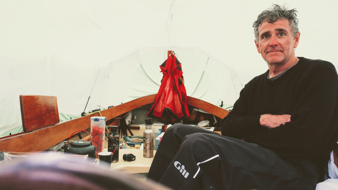
Brian Hogg
The trip home became increasingly difficult with rising wind and large broken swells from behind occasionally easily reaching 3 metres. Had they been regular and orderly it would have been less exhausting but as it was the boat was all over the place as the swells came from varying angles, many of them with “vertical” faces. In the drive to get home I left the full rig up but in hind sight should have hove to and put a tuck or two in. The tide carried us south and east (ebb tide in Cook Strait on the North Island side) and we failed to allow for that which meant we were carried too close to the north end of mana which is a washing machine in those conditions. We should have plotted a more northerly course which would have meant staying close hauled out of the sounds for a couple more hours but would have put the wind more astern on the run home and kept us well north of Fisherman’s rock, Cook Rock and allowed a more northerly approach to Mana Island.
Ironically we shared fuel around before leaving n case we ran out of wind (10 knots or less was forecast) but again what we experienced was very different.
Would I do that trip again in Emeraude? Not immediately but next time would have a competent crew member to share the load. This is a journey over a very changeable stretch of water which is clearly difficult for the boffins to forecast accurately over the whole distance and over 8 to 10 hours travel. It is exhausting and tired wet cold people make poor decisions and Cook Strait is not a place for mistakes. I will ensure a course further away from the likes of Fisherman’s Rock.
Navigation. My Etrex10 GPS was great, especially in poor visibility but while a GPS will tell you where to head to they don’t tell you where you are. In poor visibility you need more than a GPS. As an experiment I had the Navionics App running on a cheap Chinese tablet with a Garmin Glo sending it accurate positioning. Keeping it away from all the spray and water flying about meant it was of little value on the journey but on odd occasions I got to see exactly where I was. For next time I will arrange some method of having that viewable in torrid conditions and some method for securing the GPS where it can also be viewed easily.
Batteries.. The ETrex10 had 2 new Eveready Alkaline batteries which lasted over 30 hours.
The boat has a 22ah AGM battery which ran the bilge pumps, air bed blower and charged the VHF radio, Tablet and cell phone without issue.
To keep the tablet going for over 12 hours I plugged a $30 ( from the Warehouse) 10000mah Powerbank into it and it was still going after 24 hours .
Cheers
Brian Hogg
